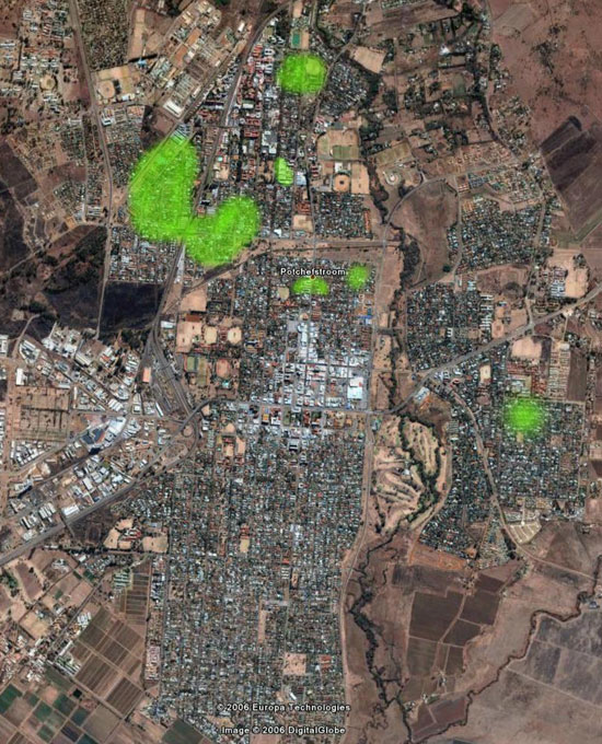
Coverage Map
THIS MAP SHOULD BE USED AS A ROUGH GUIDE ONLY.
Buildings, trees and the natural topology of the terrain all influence the
propagation of radio waves. Don't take this map as a definite yes or no of
whether you are within signal range.
The green areas represent a conservative estimate of outdoor coverage. You may well
be outside the green areas, and still be able to connect. Or you may be inside the
green areas, and not be able to connect, due to obstructions or interference. With a
dish or grid antenna, you can connect from several kilometres away, if there are no
obstructions in the signal path.
Check back regularly, as the network is rapidly expanding!

|